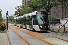
Opened 2011. Single light rail line serving 35 stops. See Jerusalem network map.

Work on the Red line (Line 1) began in 2002 and it opened on August 19 2011, linking Mount Hertzl in the west to ’Heil Ha-Avir to the north of the city (13·8 km, 23 stops). Extensions were constructed at both ends of the line - north from Heyl Ha-Avir to Neve Ya’akov (2·5 km, 4 stops), and southwest to Hadasseh Ein Kerem (4·9 km, 8 stops). These opened on February 27 2025, taking the line to 22·5 km long with 35 stops.

A concession to build and operate the Green line (Line 2) was awarded in 2019. This is planned to run from Mount Scopus university campus west to the Central station, and then south to Dov Yosef, Malcha and HaMargalit (19·6 km, 36 stops), crossing the Red Line twice.

A further line in planning is the Blue line, from Ramot in the northeast to Gilo and Talpiot in the southwest (31 km, 53 stops, including a 2·5 km tunnel section with 3 sub-surface stops). A contract to finance, build, operate and maintain the line was awarded to J-Train consortium of Dan Bus, construction company Denya Cebus and Spain’s Comsa in autumn 2023. Pesa is to supply a fleet of 132 three-section trams.

The CityPass consortium was replaced as operating concessionaire by Cfir (CAF and Shapir Engineering) on April 16 2021. Cfir has a 15 year concession including extending the Red Line and completing the Green Line, with CAF to supply 114 Urbos LRVs.

Address
1 Shazar Avenue
Jerusalem
Israel
Phone
+972 2 659 5222
Fax
+972 2 651 3660
Email
idit@citypass.co.il
Website
www.citypass.co.il
 

Traffic

YearPassenger journeys
(million)
Opened 2011-08-19
2022 31·0
2021 37·3
2018-20 no data
2017 42·5
2016 37·6
2015 36·4
2013-14 no data
2012 31·0
 

Network data

Gauge
1435 mm
Length
22·5 km
Electrification
22·5 km - 750 V DC
Rolling stock
46 LRV/tram cars