


All Tamil Nadu articles
-
-
Organisations
Southern Railway (SR – India)
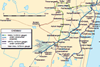
First line opened 1853. See India network map. Southern Railway is a zonal constituent of Indian Railways, comprising six divisions: Chennai, Madurai, Palakkad, Tiruchirappalli, Salem and Thiruvananthapuram. The network stretches from Gudur in the northeast to Kanyakumari in the south, serving 561 stations primarily in Tamil Nadu and Kerala, with ...
-
Organisations
Chennai Metro Rail Ltd (CMRL)
Opened 2015, India’s 7th metro. Two lines serving 40 stations. See Chennai network map. CMRL is a special-purpose vehicle of the state of Tamil Nadu responsible for planning, design, implementation and operation of the Chennai metro. Construction of Phase 1 started late-2008 on the Blue (23·1 km, 18 stations) and ...
-
Organisations
MRTS, Chennai Metropolitan Transport Project (Railways)
Single elevated urban railway opened 1995, serving 18 stations. See Chennai network map. Phase I of this partially elevated urban railway opened on November 1 1995 from Chennai Beach to Chepauk, extended to Thirumayilai in October 1997. The line was extended further south to Thiruvanmiyur in January 2004, and on ...
-
Organisations
Chennai Port Trust Railway
Operates in the port area of Chennai, providing interchange with Southern Railway handling general cargo, wheat, fertilizer, limestone, dolomite, hot-rolled coils, steel, slag, granite blocks, maize, baryte and other commodities from Tamil Nadu and neighbouring states. AddressNo 1 Rajaji SalaiChennai - 600001IndiaPhone+91 44 2536 2201Fax+91 44 2536 1228Emailchairman@chennaiport.gov.inWebsitewww.chennaiport.gov.in ...