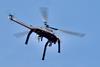
UK: Contractor Osborne and digital twin specialist Sensat have completed fixed-wing drone surveys of South Western Railway’s Barnes, Isleworth, Stoneleigh and Wandsworth Town stations, collecting data need to plan accessibility works such as the installation of lifts and ramps under Network Rail’s Access for All programme.
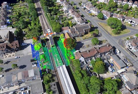
Sensat captured 0·14 km2 of photogrammetric data in two days, covering the various buildings, stairs, canopies, bridges, track and signals. The data has been made available to Network Rail in Sensat’s common visualisation environment tool.
‘Surveying live rail networks and stations using traditional methods would not only have been costly for Network Rail, but could have taken considerable time’, said Sensat CEO James Dean. ‘Sometimes it can take a ground-based team months to secure land and track access before a manual survey can be conducted. Network Rail required a fast and accurate survey to enable them to plan, design, develop and integrate new structures into existing platform environments safely and efficiently, while keeping stations up, running and open.’
Osborne commissioned Arcadis to provide full design support for the station structure works.
‘Making sure that we could capture a minimum accuracy (±10 mm) of survey detail, as well as obtaining highly-accurate 3D topographical survey drawings and point cloud data, was critical for enabling design to proceed’, said Paul Mountford, Framework Manager at Arcadis. ‘Using Sensat’s visualisation platform is now enabling us to digitally access all above and below-ground information, including buried services, below-ground utilities and all engineering design data, facilitating efficient progression of the design and a reduced requirement for repeat site visits.’