
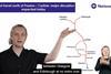
UK: Visual Disruption Maps have been launched to explain what is happening when train services are disrupted, how services are affected and what travellers should do next.
The short videos can be produced within 30 min of services being affected by sudden events such as signal failures, infrastructure damage or flooding, and will be made available on the National Rail Enquiries website, app and social media feeds.
Each video features a presenter stood in front of a map of the rail network to explain what has happened, the impact on services and the next steps for travellers to take. They will include subtitles and British Sign Language wherever possible.
The rollout follows the successful launch in December 2024 of video explainers for planned disruptions. These provide information and advice about planned or actual disruption such as engineering works. More than 250 videos have been produced so far and viewed nearly 700 000 times.
The project forms part of the Smarter Information, Smarter Journeys cross-industry initiative involving the Rail Delivery Group, Network Rail and train operators.
‘Customers want clear and timely information they can trust’, explained Rail Delivery Group Executive Chair & CEO Jacqueline Starr on September 22. ‘Visual Disruption Maps bring a human face and voice to real-time events, helping people to travel with confidence when journeys don’t go as planned.’