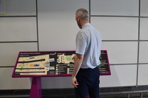
UK: TransPennine Express has installed Map for All tactile maps developed and produced by the Royal National Institute of Blind People to help blind and partially sighted passengers navigate Hull Paragon, Dewsbury and Manchester Airport stations.
The maps have a mixture of layers, visual contrasts, textures, raised large print and braille lettering, as well as tactile and visual symbols, so that they can be read by sight, touch or a combination of both.
Similar maps are to be installed at Huddersfield, Middlesbrough and Scarborough.
‘We are committed to making our services as inclusive and accessible as possible and are continuously looking for new and innovative ways to achieve this’, said TPE’s Accessibility & Transport Integration Manager Chris Jeffrey on August 18. ‘We installed the maps following feedback from our Customer & Professionals Accessibility Panel who suggested a physical alternative to the many digital wayfinding innovations TPE already has in place.’
Earlier this year TPE launched My Station View virtual tours and began using the GoodMaps Explore app to help people navigate its managed stations.