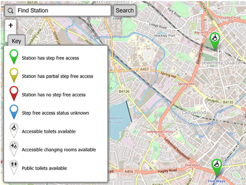
UK: An ‘Access Map’ has been launched to provide rail users with information about accessibility at stations. This includes whether stations have step free or partial step free access; what facilities are available, including accessible toilets and changing places, and alternative accessible stations.
Developed by the Rail Delivery Group, train operators and the Department for Transport, the Access Map is designed to be compatible with accessible features on iPhone, Android and desktop computers, including for visually impaired people. An app is to be released in the coming months.
‘Our new map will help to boost passengers’ confidence when they travel by train, eliminating the element of surprise and giving them the reassurance that comes with planning a journey and knowing what to expect’, said Robert Nisbet, Director, Regions & Nations at the Rail Delivery Group.