


All Indonesia articles
-
-
-
Organisations
Palembang Light Rail Transit
Single elevated light metro line opened 2018, serving 13 stations. Linking Sultan Mahmud Badarudin II International Airport in the northwest with Jakabaring Sport City / DJKA to the southeast, this line was opened on August 1 2018 in time for the Asian Games. The train fleet was supplied by PT ...
-
Organisations
PT Mass Rapid Transit Jakarta
Opened 2019. Three routes, together serving 36 stations. See Jakarta network map. Ground breaking for the Phase 1 of the MRT North-South line from Lebak Bulus to Bundaran Hotel Indonesia took place in October 2013, with the line opened on March 24 2019 (15·7 km, 13 stations). Work on an ...
-
Organisations
Ministry of Transport, Indonesia
The responsibilities of the Minister extend to all matters relating to land transport and inland waterways; railways, sea and air transport; meteorological and geophysical studies, and search and rescue operations. Address8 Medan Merdeka Barat Street10110 JakartaIndonesiaPhone+62 21 381 1308Fax+62 21 386 0758Emailinfo151@dephub.go.idWebsitedephub.go.id
-
Organisations
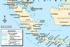
PT Kereta Api Indonesia
First line opened 1864. The State Railway (formerly PJKA) became a public corporation in 1990. The isolated West Sumatra line from Padang to Sawahlunto (148 km) includes a 36 km rack section. The three separate operations on Sumatra together total 1305 km, while Java has a 3370 km integrated network. ...