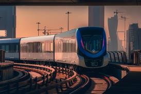


MALTA: Transport Malta has published a feasibility study and a strategic business case for the development of a 35 km underground driverless light metro network serving the principal urban area around Valetta.
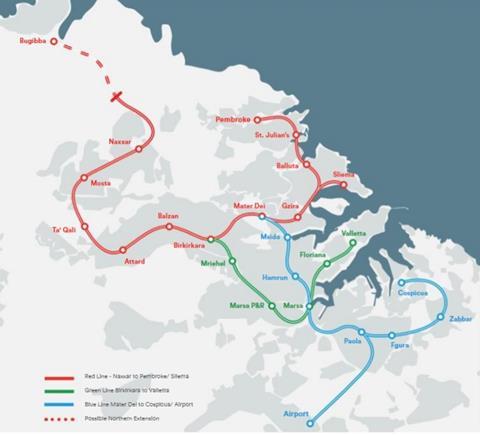
The studies for a mass rapid transit network were undertaken by Arup under a contract awarded by Transport Malta in 2016, and considered a range of modal options, including buses and light rail, before recommending a light metro. The network would be mostly underground, with the proposed northern extension to Bugibba being elevated.
| Proposed Malta light metro network | |||
|---|---|---|---|
| Line | Route | Length km | Stations |
| Red | Naxxar - Pembroke/Sliema | 16 | 11 |
| Blue | Mater Dei - Cospicua/Airport | 12·5 | 9 |
| Green | Birkirkara - Valetta | 7 | 6 |
| Red (northern extension) | Naxxar - Bugibba |
The cost is estimated at €4·3bn. Subject to funding and planning permission being secured, it is envisaged that construction could begin in 2024 for opening in three phases by the end of 2029, 2035 and 2040.
The metro is predicted to increase public transport’s modal share by 30% and save 25 000 tonnes of CO2 per year.