INTRO: German Railway is currently automating the administration of its network infrastructure data using the DB-GIS geographical information system

GERMANY’s rail network - like others in Europe - is undergoing a fundamental transition from a state-protected monopoly into a competitive market-oriented transport provider. Driven by a political desire to boost rail carryings and cut the cost to taxpayers, DB has been restructured into separate businesses with an infrastructure provider (DB Fahrweg) and a number of train service operators who must compete with international or domestic ’open access’ operators who may emerge from the private sector.

DB Fahrweg is responsible for all infrastructure on the 40000 km network, ranging from civil engineering structures such as bridges and tunnels, through signalling, overhead electrification equipment and communications to maintenance machinery and technical support systems.

It is the infrastructure provider which effectively determines the competitiveness of the entire rail transport chain, through the quality of network and the price charged for access. To optimise the performance of the network, DB has decided to invest heavily in rationalising and modernising its infrastructure management processes. A key step was the decision to set up a unified, organisationally-neutral data processing structure to hold all area-related information. This combines both graphic and alphanumeric data, allowing easy and immediate access to current, consistent and accurate information. As well as saving time and cost for accessing the data internally, the new system will improve the flow of information to and from external contractors.

There is also potential to boost the use of the rail network by making available information not previously obtainable, which can now be derived by comparing data once held in incompatible formats.

Integrated information objects

The need to handle as much information as possible and to accommodate the needs of different users established the parameters for the technical design of DB-GIS, as the system is now known. Important considerations were the task-specific functions of several fields, such as measurement engineering, electrical engineering, signal engineering, or construction, and the various structures of the data for each field: topological, graphic, logical, alphanumeric, scans, and so on. At the same time it was important to ensure that the comprehensive data model remained manageable in all its complexity.

These requirements are being met by the use of an object-oriented information model. In DB-GIS each object consists of an intersection of the sets of basis data, common to all users, and the field data for the individual fields. An object can contain any number of graphic or alphanumeric components, together with all the necessary interconnecting attributes to other objects. The organisational framework ensures that information objects are correctly positioned in the co-ordinate network, and also in the route and track network’s topological node and margin model.

A second factor determining the structure of DB-GIS arose from the extremely complex nature of the existing data. DB is one of the largest real estate holders in Germany, and has a library of more than 300000 plans. And as a result of the merger of Deutsche Bundesbahn and Deutsche Reichsbahn in 1991, there are two largely-independent sets of railway information which exist in many different forms and in just as many different locations.

Thus there are many plans at present which only exist on paper in analogue form, and some of these are potentially incapable of being processed. Even information already held in digital form often requires considerable reworking before it can be transferred to DB-GIS. These essential transfer processes and information conversions will tie up a large proportion of DB’s specialist resources in the longer-term.

General contractor appointed

Given this background, DB-GIS is one of the most comprehensive geographic information systems to be initiated anywhere in the world. It will incorporate three interdisciplinary information systems developed in the early 1990s: floor plans (measurement), schematic plans (electrical engineering and railway engineering) and object plans (construction).

The decision to proceed with DB-GIS was effectively taken at the end of 1994, when DB Fahrweg appointed the Dutch firm Intergraph as general contractor. As a worldwide GIS provider with a broad spectrum of applications, Intergraph had available a range of standard and railway-specific software packages.

The system concept for DB-GIS uses a central standardised user shell, based on the Framme object management system, MicroStation CAD graphics, and an Oracle 7.0 relational database. Along with this are a series of operating modules, such as InRail - a planning and design tool for track location. Other modules include grid and plotting packages, applications for sewer registering, real estate administration and environmental information. The hardware consists of Intel computers running under Windows NT.

To simplify the application for different types of users, DB-GIS has a series of field-specific user interfaces, known as field shells. The first of these field shells has now been completed for the measurement engineering group, and has been installed in approximately 100 workplaces within DB. Additional field shells for electrical engineering and signal engineering are now being constructed, and should soon be installed in a further 90 workplaces.

While in principle DB-GIS allows unlimited access to the entire DB computer network so that users can draw on any of the available information, this is not normally necessary for external users. Intergraph has therefore developed in parallel DB-GIS-Lite, an off-line data acquisition solution for use by sub-contractors and suppliers. DB-GIS-Lite also uses MicroStation and Framme-Lite, so all the object structures are fully data-compatible.

Further development

With the first substantial batch of DB-GIS workstations operational by the end of 1996, work is now being focussed on ensuring that the system is in full working order. Since the beginning of 1997 all measurement work undertaken by DB’s four main planning subsidiaries has been converted to DB-GIS.

At the same time, the migration process of converting historical data is under way as fast as possible. The aim is to have all details of the DB route network, with its related track geometry and topology, loaded on to the database by the end of 1998. In a transitional phase, a hybrid solution is now available, with the scanned analogue and digital plans that have not yet been transformed into information objects also available through the DB-GIS network.

The information gains being achieved by DB with the step-by-step development of DB-GIS cannot be overestimated. The ultimate goal is to have a comprehensive suite of consistent high quality data. This will clearly reduce the time and cost of future planning for infrastructure maintenance and new construction. As a homogeneous information management system, DB-GIS is already permitting better use of personnel and resources within DB Fahrweg.

The second important benefit comes with the reduction of information maintenance costs. The unified data acquisition and processing methodology now available to all participants should help to eliminate duplicate tasks from the outset. At the same time, creation of standardised data exchange interfaces has lowered considerably the cost of linking up to external information providers.

In its third goal, DB-GIS is finally starting to realise some completely new information opportunities, through the combination of individual plans within closed network topologies. With these data files, geodesic or railway engineering evaluations and analyses can now be carried out. For example, it is possible to calculate optimal routes to avoid clearance bottlenecks, or to optimise running speeds, or even to carry out complete transport simulations. By enabling better utilisation of available routes, DB-GIS is bringing DB a step closer to its ultimate target: to carry more passengers and freight by rail. o

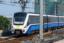
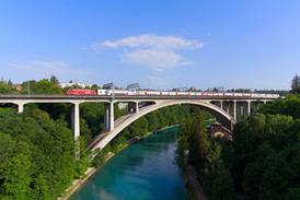
CAPTION: Engineers within DB Fahrweg and external contractors have much faster access to structural details of bridges, tunnels and viaducts through GIS. Single integrated information objects can include a large quantity of technical parameters and graphic elements

CAPTION: GIS should make management of DB’s 40 800 route-km of infrastructure simpler, while giving contractors better access to information

La modélisation du réseau simplifie la gestion des données d’infrastructure

Les Chemins de fer allemands automatisent actuellement l’administration des données d’infrastructure de leur réseau avec le système informatique géographique DB-GIS. Ce système fournit une solution très complète concernant l’enregistrement, l’évaluation et la visualisation de toutes les informations associées aux régions et aux itinéraires, qui peuvent être ensuite mises à la disposition du personnel et des prestataires de services dans une variété d’applications différentes, sous une forme supportée par CAO

Netzmodellierung vereinfacht Verwaltung von Infrastrukturdaten

Die Deutsche Bahn automatisiert derzeit die Verwaltung ihrer Netzinfrastrukturdaten mit dem geographischen Informationssystem DB-GIS. Dies stellt eine Gesamtl

Topics