


Completion last December of China’s 1446 km South Xinjiang Railway to Kashi leaves a gap of less than 500 km to be closed in a historic trade route. Richard Hope reports on plans for a national network in the Kyrgyz Republic that will meet this need
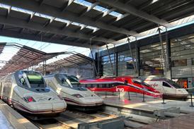
ADDRESSING the Ninth National People’s Congress on March 5, Minister of Railways Fu Zhihuan said that more than 3000 km of new railway was to be built in western China. He laid particular stress on the need to improve connections with the newly independent states of Central Asia, following the opening in 1991 of the Alatau Pass route to Kazakhstan.
In addition to this increasingly busy route with its gauge transfer station at Druzhba, two more links are to be built. One would diverge from the Druzhba line to reach Yining before crossing into Kazakhstan 80 km west of that city. From there it would follow the River Ili to reach Almaty.
However, even more importance is attached to the proposed route through Kyrgyzstan. This would cut more than 1000 km off the distance from Chinese ports and industrial centres to the critical Toshkent gateway in Uzbekistan, where a major multi-modal logistics centre is planned.
A ceremony on December 6 1999 marked completion of the South Xinjiang Railway to Kashi, the most westerly city in China, also known as Kashgar. This was a massive project, even by Chinese standards, since Kashi is 1446 km from Turfan where the line branches off the route to Urumqi and Druzhba.
Mr Fu made it clear that Kashi is not intended to be the end of this strategically important railway. It lies on the historic Silk Route that carried trade between China and early civilisations in the Middle East, and is seen in Beijing as having great potential.
Two priorities
For the moment, the China’s enterprising railway builders can go no further. They face mountain passes over 3000m high, through which responsibility for building some 500 km of railway to connect with the former Soviet Railways 1520mm network lies with Kyrgyzstan, smallest of the five republics that formerly made up Soviet Central Asia.
The substantial mineral wealth of Kyrgyzstan was never exploited by the Soviet Union, and independence in 1991 left the new state with railheads, but no internal rail network. Freight between the two main centres of population and industry - Bishkek (formerly Frunze) in the north, and Osh and Jalal-Abad close to the border with Uzbekistan - has to go 1267 km via Toshkent. In so doing, it has to pass through three other countries.
The government of Kyrgyzstan therefore has two priorities: to provide a direct north - south link within its own borders, and to complete the east - west trade corridor by linking up with Kashi in China.
The Gibb study
Once the Kyrgyzstan economy had begun to recover from the severe recession caused by the disintegration of the Soviet Union, with its reliance on central control from Moscow, a number of reports were prepared. These outlined the benefits of a rail network, but also the formidable obstacles facing railway builders in this mountainous terrain.
In 1998, the government asked international consultants Gibb to review this work, and undertake a pre-feasibility study that would point the way forward.
Meanwhile, construction had started on the first 64 km of the north - south line from Balykchi to Kochkor, specifically to serve a coal mine at Kara-Keche. This section was designed in 1994 and is now substantially complete.
In 1997, the Chinese, Kyrgyz and Uzbek governments met in Toshkent to sign two crucial agreements governing the construction of a new line from Kashi to Andizhan, an important railway junction in eastern Uzbekistan. This was to cross the Chinese frontier at Irkeshtam and then turn north at Sary-Tash to pass through Osh before heading directly to Andizhan, a total distance of some 600 km.
So when Gibb accepted their brief, there was a general assumption that the north - south and east - west links were independent projects, one internal and the other international. Gibb was not required to examine the connections to Kashi on Chinese territory, nor to consider what upgrading might be necessary inside Uzbekistan.
Criteria adopted by Gibb for the new lines were a maximum gradient of 3%, minimum curve radius of 250 to 300m, gross train weight between 1800 and 2800 tonnes, and train length at 600 to 850m. This was considered to be the minimum acceptable, given the tonnage to be moved, although flatter gradients and easier curves were to be adopted where practicable.
It was also assumed that the lines would be single track with passing loops at 50 to 60 km intervals, although the possibility of future doubling would be included in design criteria. In view of the steep gradients, long tunnels and availability of hydro power in the region, electrification was costed in.
Engineering risks in the area are considerable. For example, major structures would have to be designed for a typical peak ground acceleration of 0·6 g due to earthquakes.
Optimising the routes
Selection of the north - south alignment was relatively straightforward. A local study by Kazghiprozheldortrans had already identified the most direct route via Kazarman as the better option, the distance from the railhead at Kochkor to Kazarman being 226 km.
An alternative route through the city of Naryn, and then up the valley of the River Naryn to Kazarman was considered but rejected. It would be longer at 298 km, with a difficult sector through a narrow gorge on the Naryn. Both routes rise to over 3000m to cross mountain ridges.
A third possibility was to take the line through Kara-Kul to the railhead at Task-Kumyr. This was rejected because the connection to Jalal-Abad and Osh would be through Uzbekistan, raising issues of national sovereignty. However, Gibb notes that the existing line between Jalal-Abad and Osh via Kara-Su already passes through Uzbek territory. Construction of a 31 km deviation would be necessary to avoid this situation.
Though only 97 km long, the direct route from Kazarman to the railhead at Bagish station, 13 km from Jalal-Abad, would be difficult and expensive to build. An 8·3 km tunnel is required through the Fergana ridge, and it would also be necessary to double back to gain height on the climb from Kazarman. Nevertheless, this was the option endorsed by Gibb.
Given that Kazarman was definitely to be on the north - south line, Kazghiprozheldortrans had already examined an alternative to the southern route into China envisaged under the tripartite agreement signed in 1997. This would follow the Arpa river and cross the frontier at Torugart, where the present road reaches 3752m.
Gibb’s geologists and engineers examined both routes, and did not like what they saw. The previously favoured southern route to Kashi through Irkeshtam would be difficult and expensive to construct, with gradients likely to be steeper than a Jalal-Abad - Kazarman - Torugart route. In addition, the section between Sary-Tash and Irkeshtam lies close to the border with Tadzhikistan and might attract higher insurance premiums on freight.
As for the Arpa river, visual inspection by helicopter revealed that the gorge in which it lies would be extremely difficult to construct a railway through. Gibb therefore came up with a parallel route which, although 49 km longer, would be at least $200m cheaper to build. Even so, there are two ridges to be crossed, both of which will require substantial tunnelling.
Economics
Gibb based its estimated costs on electrification between Bishkek, Jalal-Abad and Torugart, using a fleet of six heavy-haul locomotives similar to the Swiss Lok 2000. The capital cost of the east - west route alone was $2·3bn, and assuming that the line opened in 2006, and ’European’ tariffs were charged for transit freight, revenues would exceed investment and operating costs around 2021.
A further case was considered in which the north - south line was completed between Kazarman and Kochkor, including electrification to Bishkek, around 2020-23, and much lower ’local’ tariffs were charged on this route. This lifted the total capital cost to over $5bn, and cumulative revenues exceeded total costs early in the 2030s.
Following an agreement at the latest Traceca (Transport Corridor Europe - Caucasus - Asia) conference - held at Tbilisi in March - that the project should be developed, the Kyrgyz government formed a State Department to take the scheme forward. The department has since been approaching various international funding institutions and private contractors, with the aim of launching a detailed feasibility study and raising funds for construction of the new lines.