


All Ontario articles
-
 Country profile
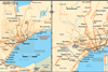
Toronto & Mississauga - region map
Toronto (& Mississauga), Canada: region rail network map
-
Organisations
Toronto Transit Commission (TTC)
First tramways opened 1861, first metro line 1954, and Intermediate Capacity Transit System (ICTS) light metro route in 1985 (closed 2023). Metro comprises three lines (1,2,4) with 75 stations and a light rail line, with a central tramway network comprising 11 routes. See Toronto network map. Work to extend the ...
-
Organisations
Metrolinx
This agency of the Government of Ontario was created in 2006 to improve the co-ordination and integration of all modes of transport in the Greater Toronto and Hamilton Area. In 2009, it merged with GO Transit, the operator of Toronto’s regional suburban rail services. The Air Rail Link joined the ...
-
Organisations
Trillium Railway
Operates two switching lines, the Port Colborne Harbour Railway (60 km) and the St Thomas & Eastern (56 km), handling mainly grain, fertiliser, auto parts, chemicals, steel, forest products and non-ferrous metals. AddressPO Box 218265 King StreetPort Colborne, ON L3K 5V8CanadaPhone+1 905 835 2772Fax+1 905 835 8943Websitewww.trilliumrailway.com Network ...
-
Organisations
GO Transit (Toronto)
Created in 1967, GO Transit is a division of Metrolinx, the regional transportation agency for the Greater Toronto and Hamilton Area (GTHA). It provides rail and road coach services, with some routes extending beyond the GTHA into the greater ‘Golden Horseshoe’. The rail network consists of seven routes serving 64 ...