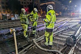
Berlin U-Bahn Hauptbahnhof help point (Photo BVG, Joite)

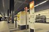
GERMANY: Synectics has developed a digital mapping tool to provide Berlin U-Bahn control centre staff with accurate locational and contextual information to support incident response.

‘For security reasons, we operate a closed system, so we can’t access open web-based tools such as Google Maps’, said Steffen Holz, who is responsible for IT infrastructure at Berlin transport operator BVG’s U-Bahn stations. ’But this level of mapping detail is needed to give situational context to any incident reported to us.’

Synectics has combined schematic interactive station maps with a geographic information system developed using data sets from the city of Berlin, including street names, landmarks and other key identifiers.

Control staff can quickly access the location of stations, cameras and security personnel, and switch between data layers for an accurate real-time view of U-Bahn operations.

If one of the 550 passenger emergency points is activated, video and audio are immediately streamed to the control centre, with staff able to view location details in order to provide appropriate assistance.

The interface has been designed to be quick to use. ‘The way data is displayed on screen significantly affects how fast you can respond to a particular scenario’, said Holz. ‘The updated system is much more intuitive, with layouts, colour-coding, icons and many other features, tailored to the way we work. For handling any security incident, the right tool is now only one click away.’

Future plans include the possible use of video analytics to support threat detection.